Bilașco, Ș.; Roșca, S.; Vescan, I.; Fodorean, I.; Dohotar, V.; Sestras, P.
Appl. Sci. 2021, 11(11), 4847; https://doi.org/10.3390/app11114847
Abstract
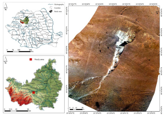
The accentuated degradation of agricultural lands as a result of deep erosion processes is the main problem identified in abandoned agricultural lands under the rainfall intensities, increasing number of hot days, indirectly under the impact processes derived from them (soil erosion, vegetation drying, etc.), as well as inadequate or poor management policies implemented by local authorities. The present study aims to develop and present a methodology based on GIS spatial analysis to choose the best hydro-amelioration solution for the arrangement of a complex ravine that negatively affects the entire agroecological area in its immediate vicinity. The proposed model is developed on spatial databases obtained based on UAV flights, the simulation of flow rate values and the establishment of three hydraulic analysis models through the HEC-RAS software with the main purpose of evaluating the results and databases, in order to identify the best implementing model for the stabilization and reduction in erosion within the analysed area. The comparative analysis of the three analysed scenarios highlighted the fact that a dam-type structure with overflow represents the best hydro-ameliorative solution to be implemented in the present study. The accuracy of the obtained results highlights the usefulness of developing GIS models of transdisciplinary spatial analysis to identify optimal solutions that can be implemented in territories with similar characteristics. View Full-Text