Geocarto International, 37:2, 627-637, DOI: 10.1080/10106049.2020.1730450
Abstract
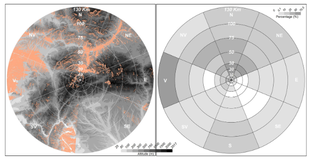
Visibility analyses are employed in various fields, from landscape to archeology or territorial planning. Two case studies, of different elevation, from Romania were selected to be considered for setting up some observation points as lookout points. Fuzzy viewshed analysis was performed to evaluate the degree of visibility of certain landscape components and was also used as a tool for territorial planning. The main results of the research were some particular viewshed analysis area according to the dominant visibility directions. This methodology may be useful to local authorities, which are the only responsible bodies for authorizing, creating and setting up lookout points in a given space or for organizing certain planning activities.