Avram, S.; Cipu, C.; Corpade, A.-M.; Gheorghe, C.A.; Manta, N.; Niculae, M.-I.; Pascu, I.S.; Szép, R.E.; Rodino, S.
Int. J. Environ. Res. Public Health 2021, 18(11), 5915;
Abstract
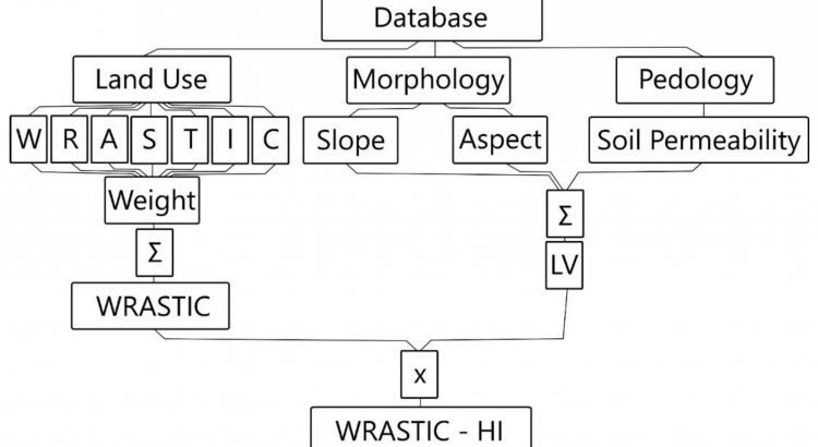
In general, the elaboration of the synthesis of water quality in Romania is based on the processing of a large volume of information coming from primary analytical data collected with a constant frequency by the organisms with a specific role in water quality monitoring. This study proposes a novel methodology for multi-criteria analysis aiming to evaluate the degradation state of lake ecosystems. The cornerstone of the newly presented methodology is a geographic information system (GIS) automated tool, involving the assessment of potential degradation sources affecting the watershed that supply the lakes with water. The methodology was tested by performing an analysis on 30 lakes in Romania. The lakes belong to different geographical areas, owing various natural specific conditions and were selected to fit to various types and specific local conditions. The calculation of the WRASTIC-HI (Wastewater–Recreation–Agriculture–Size–Transportation–Industry–Cover–Hazard Index) revealed that, out of 30 lake ecosystems selected as the case study, two lakes were fully degraded, 24 lakes were semi-degraded, and four were in a natural state. The four lakes characterised by a natural state are located in mountainous regions or in the Danube Delta. The results obtained on the selected lakes proved that the proposed index calculation corresponded in all case studies to the real field situation, highlighting thus the accuracy of the assessing process and increased advantages of the assessment’s automation. View Full-Text
